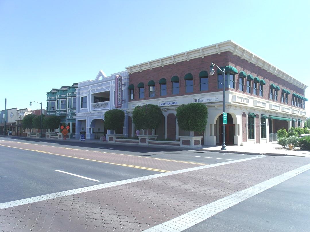
Heritage Court in Gilbert's historic district

Outdoors

Wildlife viewing and birding near Gilbert

Refuges, lakes and wild areas near Gilbert for wildlife viewing and birdwatching.

25places to see wildlife
28 mito the closest
1within 30 miles

Good to know: Early mornings and evenings are best for wildlife; bring binoculars and keep a respectful distance.

Closest picks

1

Quartz Peak Trail

28 mi west · Bureau of Land Management

Quartz Peak Trail, in the 14,400-acre Sierra Estrella Wilderness , leads visitors from the floor of Rainbow Valley (elevation 1,550 feet) to the summit ridge of the Sierra Estrella at Quartz Peak (elevation 4,052 feet) in just three miles.
2

Riverside Campground (AZ)

33 mi north · USDA Forest Service

Riverside Campground offers more peace and tranquility than the busier recreation sites at Bartlett Lake. With the campground’s proximity to water, fisherman and avid water recreationalists enjoy this spot all year long.

3

Burnt Corral Campground

39 mi northeast · USDA Forest Service

Burnt Corral Campground and Recreation Area (elevation 1914') is about 5.8 miles south of Roosevelt Dam along the Apache Trail (AZ Hwy 88) along the shoreline of Apache Lake.

Map of all 25 places

Map of 25 places loads as you scroll.

Within 30 miles (1)

28 mi west · Bureau of Land Management

Quartz Peak Trail

Quartz Peak Trail, in the 14,400-acre Sierra Estrella Wilderness , leads visitors from the floor of Rainbow Valley (elevation 1,550 feet) to the summit ridge of the Sierra Estrella at Quartz Peak (elevation 4,052 feet) in just three miles.

  • Hiking
  • Wilderness
  • Wildlife viewing

30 to 75 miles (24)

33 mi north · USDA Forest Service · Campground

Riverside Campground (AZ)

Riverside Campground offers more peace and tranquility than the busier recreation sites at Bartlett Lake. With the campground’s proximity to water, fisherman and avid water recreationalists enjoy this spot all year long.

  • Birding
  • Camping
  • Canoeing
  • Non-Motorized Boating
  • Photography
  • Wildlife viewing

39 mi northeast · USDA Forest Service · Campground

Burnt Corral Campground

Burnt Corral Campground and Recreation Area (elevation 1914') is about 5.8 miles south of Roosevelt Dam along the Apache Trail (AZ Hwy 88) along the shoreline of Apache Lake.

  • Biking
  • Boating
  • Camping
  • Fishing
  • Hiking
  • Paddling
  • Photography
  • Picnicking

43 mi northwest · Bureau of Land Management

Black Canyon National Recreation Trail

The 80-mile Black Canyon Trail provides visitors with a long-range backcountry trail riding, mountain biking, and hiking opportunity.

  • Accessible Facility Or Activity
  • Camping
  • Hiking
  • Horseback riding
  • Mountain Biking
  • Picnicking
  • Wildlife viewing

43 mi north · USDA Forest Service · Campground

C C C (AZ) Tonto NF

Civilian Conservation Corps Campground offers spread out camp sites with large sycamore trees providing shade. Picnic tables and firepits with cooking grates are available for families to enjoy while passing the time away together.

  • Birding
  • Camping
  • Hiking
  • Mountain Biking
  • Off Road Vehicle Trails

43 mi northeast · USDA Forest Service · Campground

Cholla Campground

Cholla Campground at Roosevelt Lake, is one of several campgrounds on the shores of the largest lake/reservoir located entirely in the State of Arizona. It is situated within a lush sonoran desert landscape at an elevation of 2168'.

  • Biking
  • Boating
  • Camping
  • Canoeing
  • Fishing
  • Hiking
  • Kayaking
  • Paddling

43 mi north · USDA Forest Service · Campground

Horseshoe (AZ)

Horseshoe Campground is farther up the road from Mesquite Campground. Offering more developed campground sites with picnic tables, fire pits and access to the Verde River at campsites 11 and 12.

  • Birding
  • Camping
  • Canoeing
  • Fishing
  • Kayaking
  • Non-Motorized Boating
  • Off Road Vehicle Trails
  • Paddling

44 mi northeast · USDA Forest Service · Campground

Frazier Group Campground

The campground overlooks Roosevelt Lake and is nestled in the saguaro cactus-studded Sonoran Desert.

  • Biking
  • Boating
  • Camping
  • Fishing
  • Hiking
  • Horseback riding
  • Wildlife viewing

44 mi northeast · USDA Forest Service · Campground

Frazier Horse Campground

The Frazier Horse Campground is nestled into a Sonoran desert landscape at Roosevelt Lake, one of Arizona's most outstanding water-based recreation areas.

  • Camping
  • Horse Camping
  • Horseback riding
  • Photography
  • Picnicking
  • Water Access
  • Wildlife viewing

44 mi northwest · USDA Forest Service

Tonto National Forest

  • Biking
  • Boating
  • Camping
  • Climbing
  • Fishing
  • Hiking
  • Horse Camping
  • Horseback riding

46 mi southwest · Bureau of Land Management

Sonoran Desert National Monument

The Sonoran Desert National Monument contains magnificent examples of untrammeled Sonoran Desert landscape.

  • Backpacking
  • Birding
  • Camping
  • Dispersed Camping
  • Hiking
  • History
  • Horseback riding
  • Hunting

46 mi northeast · USDA Forest Service · Campground

Windy Hill Campground

Located on central Arizona's largest lake, Windy Hill offers great water recreation opportunities to the public.

  • Boating
  • Camping
  • Canoeing
  • Fishing
  • Hiking
  • Kayaking
  • Paddling
  • Photography

47 mi northeast · USDA Forest Service · Campground

Grapevine Group Campground

Groups are drawn to Grapevine Campground's unique setting and expansive facilities.

  • Biking
  • Boating
  • Camping
  • Hiking
  • Wildlife viewing

47 mi northwest · Bureau of Reclamation

Lake Pleasant

This newly expanded reservoir has 114 miles of shoreline for family recreation uses. The reservoir boasts a 10-lane boat ramp; parking for 200 vehicles. Recreational facilities concentrated primarily on the reservoir's western shore.

  • Biking
  • Boating
  • Camping
  • Fishing
  • Hiking
  • History
  • Off-highway vehicles
  • Picnicking

48 mi southwest · Bureau of Land Management

Lava Flow Trail

In the Table Top Wilderness within the Sonoran Desert National Monument, the Lava Flow Trail offers a hiking opportunity of light to moderate difficulty in a varied and dramatic Sonoran Desert landscape.

  • Hiking
  • Horseback riding
  • Picnicking
  • Wilderness
  • Wildlife viewing

48 mi west · Bureau of Land Management · Campground

Margies Cove West Campground

Margies Cove West Campground is located in the Sonoran Desert National Monument . includes day-use parking for ten vehicles, three primitive campsites with picnic tables and steel fire rings, a vault toilet, and informational signage.

  • Birding
  • Camping
  • Camping Area
  • Stargazing
  • Wildlife viewing

49 mi northeast · USDA Forest Service · Campground

Schoolhouse Campground (AZ)

Schoolhouse Campground is located in close proximity to the eastern shores of Roosevelt Lake with an elevation of 2,100 feet.

  • Amphitheater
  • Biking
  • Boating
  • Camping
  • Canoeing
  • Fishing
  • Hiking
  • Kayaking

49 mi southwest · Bureau of Land Management

Table Top Trail

Table Top Trail, in the 34,400-acre Table Top Wilderness , takes visitors from the floor of Vekol Valley (elevation 2,299 feet) to the summit of Table Top Mountain (elevation 4,356 feet) in just 3.5 miles.

  • Camping
  • Camping Area
  • Hiking
  • Picnicking
  • Wilderness
  • Wildlife viewing

50 mi east · Bureau of Land Management

Arizona National Scenic Trail

The Arizona National Scenic Trail spans over 800 miles from Mexico to Utah. This multi-use non-motorized, long-distance trail highlights Arizona’s topographic, biologic, historic, and cultural diversity.

  • Backpacking
  • Biking
  • Bird Watching
  • Birding
  • Camping
  • Dispersed Camping
  • Hiking
  • Horseback riding

52 mi northwest · Bureau of Land Management

Hell's Canyon Wilderness

The 9,951-acre Hells Canyon Wilderness Area is a portion of the Hieroglyphic Mountains. The most prominent peaks are Garfias Mountain at 3,381 feet (1,030.5 m) and Hellgate Mountain at 3,339 feet (1,017.7 m).

  • Backpacking
  • Climbing
  • Dispersed Camping
  • Rock Climbing
  • Wilderness
  • Wildlife viewing

55 mi east · USDA Forest Service · Campground

Kellner Group Campground

Kellner Group Site is nestled at the base of the beautiful Pinal Mountains south of Globe, Arizona. Several picnic areas are separeted from the larger group area creating a semi-secluded setting.

  • Biking
  • Camping
  • Hunting
  • Mountain Biking
  • Off Road Vehicle Trails
  • Wildlife viewing

63 mi north · Bureau of Land Management

Agua Fria National Monument

Plan Your Visit Visitors to Agua Fria National Monument can hike in rugged landscapes, view rock art, and experience wide‑open desert vistas with few built facilities.

  • Biking
  • Birding
  • Dispersed Camping
  • Hiking
  • History
  • Horseback riding
  • Off-highway vehicles
  • Photography

64 mi south · Bureau of Land Management

Ironwood Forest National Monument

The Ironwood Forest National Monument, which takes its name from one of the longest living trees in the Arizona desert, is 189,600 acres, of which 128,400 acres are administered by the Bureau of Land Management (BLM) with the balance of…

  • Backpacking
  • Bird Watching
  • Camping
  • Dispersed Camping
  • Hiking
  • Historic Sites
  • History
  • Hunting

65 mi east · Bureau of Land Management

Gila River Recreation Area

The Gila River recreation area is located along the Gila River and Arizona State Route (SR) 77 between the Town of Winkelman and Globe in Gila County, Arizona.

  • Boating
  • Camping
  • Camping Area
  • Canoeing
  • Fish Viewing Site
  • Fishing
  • Picnicking
  • Water Access

66 mi west · Bureau of Land Management

Woolsey Peak Wilderness

Congress added the Woolsey Peak portion of the Gila Bend Mountains to the National Wilderness Preservation System in 1990, citing the rugged topography, colorful scenic vistas, rich variety of wildlife and vegetation, and outstanding…

  • Backpacking
  • Camping
  • Dispersed Camping
  • Hiking
  • Horseback riding
  • Wilderness
  • Wildlife viewing

Distances are straight-line miles from downtown Gilbert. Listings come from Recreation.gov’s federal recreation database; check each official page for hours, fees, fire restrictions and closures before you go.

Get outside around Gilbert

Around Gilbert

2021 LDS Church, 3310 South Greenfield Road, Gilbert
2021 LDS Church, 3310 South Greenfield Road, GilbertBeyond My Ken · CC BY-SA 4.0
St. Thomas The Apostle Byzantine Catholic Church, Gilbert
St. Thomas The Apostle Byzantine Catholic ChurchJavert13 · CC BY-SA 4.0
Gilbert Civic Center
Gilbert Civic CenterShereth · CC BY-SA 3.0

More outdoors near Gilbert

Questions

Where is the closest place for wildlife & birding near Gilbert?

Quartz Peak Trail (Bureau of Land Management), about 28 miles west of Gilbert as the crow flies. Next are Riverside Campground (AZ) (33 mi) and Burnt Corral Campground (39 mi).

Who manages these places?

Federal agencies including Bureau of Land Management, USDA Forest Service, Bureau of Reclamation. Each listing links to its official page for hours, fees, closures and current conditions.

Gilbert AI

Your Gilbert local guide
Hey there!

I'm Gilbert AI. Ask about neighborhood food, independent shops, local history or planning a visit.

AI recommendations may be inaccurate. Verify hours and prices. Questions are processed by Cloudflare. Privacy