Gilbert weatherWhat’s on in Gilbert →Events →
Glendale

Get out of town

Day trips from Gilbert

14 nearby parks, towns and places to explore, ordered by straight-line distance.

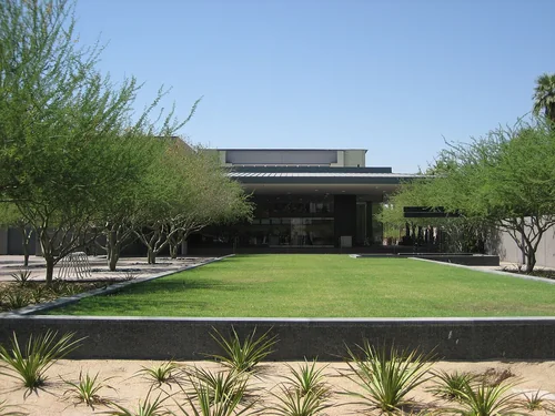
Phoenix Art MuseumThings to do

Phoenix Art Museum

18 miles northwest · straight-line distanceAbout 25 min by car (23 road miles, typical traffic, checked October 2026)

Art museum in Phoenix, Arizona.

Confirm the visitor entrance, hours, reservations, access and seasonal conditions. Islands or water destinations may require different transport.
Heard MuseumThings to do

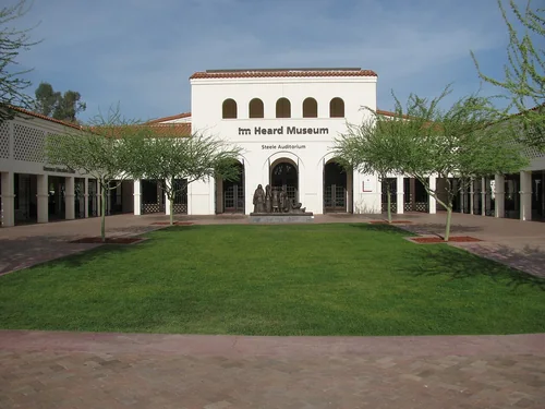
Heard Museum

18 miles northwest · straight-line distanceAbout 30 min by car (24 road miles, typical traffic, checked October 2026)

Art and culture museum in Phoenix, Arizona.

Confirm the visitor entrance, hours, reservations, access and seasonal conditions. Islands or water destinations may require different transport.
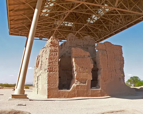
Things to do

Arizona State Capitol

19 miles west · straight-line distanceAbout 30 min by car (24 road miles, typical traffic, checked October 2026)

State capitol building of the U.S. state of Arizona.

Confirm the visitor entrance, hours, reservations, access and seasonal conditions. Islands or water destinations may require different transport.
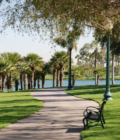
State park

Lost Dutchman State Park

19 miles east · straight-line distance

State park in Arizona, United States.

Confirm the visitor entrance, hours, reservations, access and seasonal conditions. Islands or water destinations may require different transport.
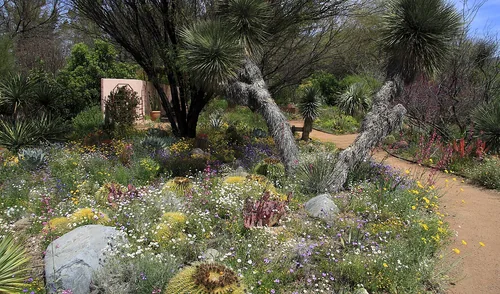
Town

Maricopa

25 miles southwest · straight-line distanceAbout 40 min by car (35 road miles, typical traffic, checked October 2026)

City in the Gila River Valley in Pinal County, Arizona, United States.

Confirm the visitor entrance, hours, reservations, access and seasonal conditions. Islands or water destinations may require different transport.
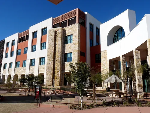
GlendaleTown

Glendale

29 miles northwest · straight-line distanceAbout 45 min by car (36 road miles, typical traffic, checked October 2026)

City in Maricopa County, Arizona, United States.

Confirm the visitor entrance, hours, reservations, access and seasonal conditions. Islands or water destinations may require different transport.
Casa Grande Ruins National MonumentNational park site

Casa Grande Ruins National Monument

29 miles southeast · straight-line distance

National monument in Coolidge, Arizona.

HistoryPicnickingAgency site ↗

Confirm the visitor entrance, hours, reservations, access and seasonal conditions. Islands or water destinations may require different transport.

Town

Peoria

30 miles northwest · straight-line distanceAbout 45 min by car (44 road miles, typical traffic, checked October 2026)

City in Maricopa County, Arizona, United States.

Confirm the visitor entrance, hours, reservations, access and seasonal conditions. Islands or water destinations may require different transport.

GoodyearTown

Goodyear

33 miles west · straight-line distanceAbout 45 min by car (41 road miles, typical traffic, checked October 2026)

City in Maricopa County, Arizona, United States.

Confirm the visitor entrance, hours, reservations, access and seasonal conditions. Islands or water destinations may require different transport.

Boyce Thompson ArboretumState park

Boyce Thompson Arboretum

37 miles east · straight-line distance

Botanical garden.

Confirm the visitor entrance, hours, reservations, access and seasonal conditions. Islands or water destinations may require different transport.

SurpriseTown

Surprise

38 miles northwest · straight-line distanceAbout 55 min by car (51 road miles, typical traffic, checked October 2026)

City in Maricopa County, Arizona, United States.

Confirm the visitor entrance, hours, reservations, access and seasonal conditions. Islands or water destinations may require different transport.

National park site

Tonto National Monument

45 miles northeast · straight-line distance

National monument in Gila County, Arizona.

HikingPicnickingAgency site ↗

Confirm the visitor entrance, hours, reservations, access and seasonal conditions. Islands or water destinations may require different transport.

State park

Picacho Peak State Park

54 miles southeast · straight-line distance

State park in Pinal County, Arizona, United States.

Confirm the visitor entrance, hours, reservations, access and seasonal conditions. Islands or water destinations may require different transport.

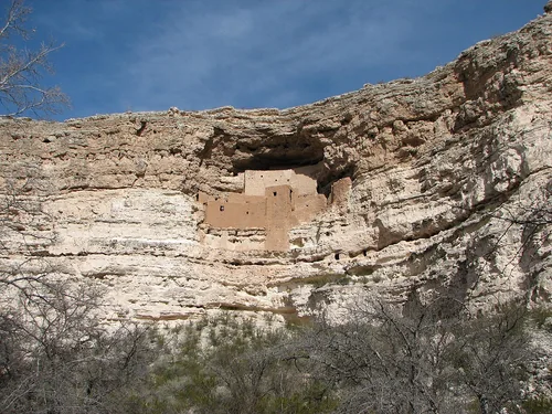
Montezuma Castle National MonumentNational park site

Montezuma Castle National Monument

87 miles north · straight-line distance

Archaeological site in the United States.

Confirm the visitor entrance, hours, reservations, access and seasonal conditions. Islands or water destinations may require different transport.

Driving times are typical estimates from the city center without live traffic, Powered by Geoapify · © OpenStreetMap contributors.

Distances are straight-line measurements from the city, not driving distance. Saved road estimates have no consistently recorded source date and are not current traffic; estimates to park centers, water locations or inconsistent routes are omitted. Named-destination route links are not verified entrances. Place descriptions come from Wikidata; photo credits below include recorded capture dates when available. A photograph does not show current conditions.

Outdoor places near Gilbert

40 recreation areas and campgrounds within 70 miles, from Recreation.gov. Filter by what you want to do.

Recreation area

WestWorld

20 miles north · straight-line distanceBureau of Reclamation

WestWorld is located in north Scottsdale at the base of the McDowell Mountains. Surrounded by the Sonoran Desert with over 360 acres of pristine landscaping, the covered Equidome Arena, Brett's Barn, and state-of-the-art equine facilities…

HikingHorseback ridingPicnickingRecreational Vehicles

Recreation area

Quartz Peak Trail

28 miles west · straight-line distanceBureau of Land Management

Quartz Peak Trail, in the 14,400-acre Sierra Estrella Wilderness , leads visitors from the floor of Rainbow Valley (elevation 1,550 feet) to the summit ridge of the Sierra Estrella at Quartz Peak (elevation 4,052 feet) in just three miles.

HikingWildernessWildlife viewing

Recreation area

Sierra Estrella Wilderness

28 miles west · straight-line distanceBureau of Land Management

The 14,400-acre Sierra Estrella Wilderness, located just 15 miles southwest of Phoenix, contains one of the most rugged mountain ranges in Arizona.

Dispersed CampingHikingWilderness

Recreation area

Casa Grande Ruins National Monument

29 miles southeast · straight-line distanceNational Park Service

An Ancestral Sonoran Desert People's farming community and "Great House" are preserved at Casa Grande Ruins.

HistoryPicnicking

Campground

Riverside Campground (AZ)

33 miles north · straight-line distanceAbout 1 hr 25 min by car (59 road miles, checked October 2026)USDA Forest Service

Riverside Campground offers more peace and tranquility than the busier recreation sites at Bartlett Lake. With the campground’s proximity to water, fisherman and avid water recreationalists enjoy this spot all year long.

BirdingCampingCanoeingNon-Motorized BoatingPhotographyWildlife viewing

Campground

Burnt Corral Campground

39 miles northeast · straight-line distanceAbout 2 hr 5 min by car (103 road miles, checked October 2026)USDA Forest Service

Burnt Corral Campground and Recreation Area (elevation 1914') is about 5.8 miles south of Roosevelt Dam along the Apache Trail (AZ Hwy 88) along the shoreline of Apache Lake.

BikingBoatingCampingFishingHikingPaddlingPhotographyPicnicking

Recreation area

White Canyon Wilderness

42 miles east · straight-line distanceBureau of Land Management

The 5,790-acre White Canyon Wilderness in Arizona is managed by the Bureau of Land Management. In 1990, the White Canyon Wilderness became part of the National Wilderness Preservation System established by the Wilderness Act of 1964.

BackpackingDispersed CampingHikingWilderness

Recreation area

Black Canyon National Recreation Trail

43 miles northwest · straight-line distanceBureau of Land Management

The 80-mile Black Canyon Trail provides visitors with a long-range backcountry trail riding, mountain biking, and hiking opportunity.

Accessible Facility Or ActivityCampingHikingHorseback ridingMountain BikingPicnickingWildlife viewing

Campground

C C C (AZ) Tonto NF

43 miles north · straight-line distanceAbout 1 hr 30 min by car (55 road miles, checked October 2026)USDA Forest Service

Civilian Conservation Corps Campground offers spread out camp sites with large sycamore trees providing shade. Picnic tables and firepits with cooking grates are available for families to enjoy while passing the time away together.

BirdingCampingHikingMountain BikingOff Road Vehicle Trails

Campground

Cave Creek Group Site

43 miles north · straight-line distanceAbout 1 hr 35 min by car (56 road miles, checked October 2026)USDA Forest Service

Cave Creek Group Site is located 20 miles north of Cave Creek and Carefree, Arizona. It is a historic campground constructed in the 1930s by the Civilian Conservation Corps (CCC).

BikingCampingFishingHikingHunting

Campground

Cholla Campground

43 miles northeast · straight-line distanceAbout 1 hr 50 min by car (91 road miles, checked October 2026)USDA Forest Service

Cholla Campground at Roosevelt Lake, is one of several campgrounds on the shores of the largest lake/reservoir located entirely in the State of Arizona. It is situated within a lush sonoran desert landscape at an elevation of 2168'.

BikingBoatingCampingCanoeingFishingHikingKayakingPaddling

Campground

Horseshoe (AZ)

43 miles north · straight-line distanceAbout 1 hr 45 min by car (60 road miles, checked October 2026)USDA Forest Service

Horseshoe Campground is farther up the road from Mesquite Campground. Offering more developed campground sites with picnic tables, fire pits and access to the Verde River at campsites 11 and 12.

BirdingCampingCanoeingFishingKayakingNon-Motorized BoatingOff Road Vehicle TrailsPaddling

Campground

Mesquite (AZ)

43 miles north · straight-line distanceAbout 1 hr 40 min by car (59 road miles, checked October 2026)USDA Forest Service

Mesquite Campground provides privacy and shade. Here you can relax under the shaded canopies of mesquite trees while listening to the sounds of water flowing from the Verde River just a short distance from your site.

CampingCanoeingFishingHikingKayakingOff Road Vehicle TrailsPaddlingPhotography

Recreation area

Estrella Wayside Recreation Area

44 miles southwest · straight-line distanceBureau of Land Management

The Estrella Wayside Recreation Area is in the Sonoran Desert National Monument . The area includes parking, picnic tables, grills, and fire rings just off Maricopa Road. Four primitive campsites are north of Maricopa Road off route 8002B.

Accessible Facility Or ActivityBird WatchingCampingDispersed CampingHikingHistoric SitesHorseback ridingPicnicking

Campground

Frazier Group Campground

44 miles northeast · straight-line distanceAbout 1 hr 45 min by car (95 road miles, checked October 2026)USDA Forest Service

The campground overlooks Roosevelt Lake and is nestled in the saguaro cactus-studded Sonoran Desert.

BikingBoatingCampingFishingHikingHorseback ridingWildlife viewing

Campground

Frazier Horse Campground

44 miles northeast · straight-line distanceAbout 1 hr 45 min by car (94 road miles, checked October 2026)USDA Forest Service

The Frazier Horse Campground is nestled into a Sonoran desert landscape at Roosevelt Lake, one of Arizona's most outstanding water-based recreation areas.

CampingHorse CampingHorseback ridingPhotographyPicnickingWater AccessWildlife viewing

Recreation area

Tonto National Forest

44 miles northwest · straight-line distanceUSDA Forest Service

BikingBoatingCampingClimbingFishingHikingHorse CampingHorseback riding

Recreation area

Tonto National Monument

44 miles northeast · straight-line distanceNational Park Service

Located within the northern range of the Sonoran Desert lie two cliff dwellings that were occupied from 1300-1450 CE (common era). They represent a vibrant culture consisting of local and immigrant groups that lived in the Tonto Basin.

HikingPicnicking

Recreation area

Table Top Wilderness

45 miles southwest · straight-line distanceBureau of Land Management

The 34,400-acre Table Top Wilderness lies in the southeastern Sonoran Desert National Monument .

HikingWilderness

Recreation area

Sonoran Desert National Monument

46 miles southwest · straight-line distanceBureau of Land Management

The Sonoran Desert National Monument contains magnificent examples of untrammeled Sonoran Desert landscape.

BackpackingBirdingCampingDispersed CampingHikingHistoryHorseback ridingHunting

Campground

Windy Hill Campground

46 miles northeast · straight-line distanceAbout 1 hr 50 min by car (94 road miles, checked October 2026)USDA Forest Service

Located on central Arizona's largest lake, Windy Hill offers great water recreation opportunities to the public.

BoatingCampingCanoeingFishingHikingKayakingPaddlingPhotography

Campground

Grapevine Group Campground

47 miles northeast · straight-line distanceAbout 1 hr 50 min by car (91 road miles, checked October 2026)USDA Forest Service

Groups are drawn to Grapevine Campground's unique setting and expansive facilities.

BikingBoatingCampingHikingWildlife viewing

Recreation area

Lake Pleasant

47 miles northwest · straight-line distanceBureau of Reclamation

This newly expanded reservoir has 114 miles of shoreline for family recreation uses. The reservoir boasts a 10-lane boat ramp; parking for 200 vehicles. Recreational facilities concentrated primarily on the reservoir's western shore.

BikingBoatingCampingFishingHikingHistoryOff-highway vehiclesPicnicking

Recreation area

Lava Flow Trail

48 miles southwest · straight-line distanceBureau of Land Management

In the Table Top Wilderness within the Sonoran Desert National Monument, the Lava Flow Trail offers a hiking opportunity of light to moderate difficulty in a varied and dramatic Sonoran Desert landscape.

HikingHorseback ridingPicnickingWildernessWildlife viewing

Campground

Margies Cove West Campground

48 miles west · straight-line distanceBureau of Land Management

Margies Cove West Campground is located in the Sonoran Desert National Monument . includes day-use parking for ten vehicles, three primitive campsites with picnic tables and steel fire rings, a vault toilet, and informational signage.

BirdingCampingCamping AreaStargazingWildlife viewing

Campground

Schoolhouse Campground (AZ)

49 miles northeast · straight-line distanceAbout 1 hr 50 min by car (91 road miles, checked October 2026)USDA Forest Service

Schoolhouse Campground is located in close proximity to the eastern shores of Roosevelt Lake with an elevation of 2,100 feet.

AmphitheaterBikingBoatingCampingCanoeingFishingHikingKayaking

Recreation area

Table Top Trail

49 miles southwest · straight-line distanceBureau of Land Management

Table Top Trail, in the 34,400-acre Table Top Wilderness , takes visitors from the floor of Vekol Valley (elevation 2,299 feet) to the summit of Table Top Mountain (elevation 4,356 feet) in just 3.5 miles.

CampingCamping AreaHikingPicnickingWildernessWildlife viewing

Recreation area

Arizona National Scenic Trail

50 miles east · straight-line distanceBureau of Land Management

The Arizona National Scenic Trail spans over 800 miles from Mexico to Utah. This multi-use non-motorized, long-distance trail highlights Arizona’s topographic, biologic, historic, and cultural diversity.

BackpackingBikingBird WatchingBirdingCampingDispersed CampingHikingHorseback riding

Recreation area

Hell's Canyon Wilderness

52 miles northwest · straight-line distanceBureau of Land Management

The 9,951-acre Hells Canyon Wilderness Area is a portion of the Hieroglyphic Mountains. The most prominent peaks are Garfias Mountain at 3,381 feet (1,030.5 m) and Hellgate Mountain at 3,339 feet (1,017.7 m).

BackpackingClimbingDispersed CampingRock ClimbingWildernessWildlife viewing

Campground

Kellner Group Campground

55 miles east · straight-line distanceAbout 1 hr 30 min by car (74 road miles, checked October 2026)USDA Forest Service

Kellner Group Site is nestled at the base of the beautiful Pinal Mountains south of Globe, Arizona. Several picnic areas are separeted from the larger group area creating a semi-secluded setting.

BikingCampingHuntingMountain BikingOff Road Vehicle TrailsWildlife viewing

Recreation area

Homestead Climbing Area

59 miles east · straight-line distanceBureau of Land Management

Sport climbing on limestone cliffs in a remote, scenic high desert backcountry within a two-hour drive from Phoenix and Tucson.

CampingCanyoneeringClimbingHikingRock Climbing

Campground

Reynolds Creek Group Campground

59 miles northeast · straight-line distanceAbout 2 hr 30 min by car (109 road miles, checked October 2026)USDA Forest Service

The Reynolds Creek Group Campground is a rustic and secluded, creek side camp located on the Pleasant Valley Ranger District in the Tonto National Forest.

Camping

Recreation area

Agua Fria National Monument

63 miles north · straight-line distanceBureau of Land Management

Plan Your Visit Visitors to Agua Fria National Monument can hike in rugged landscapes, view rock art, and experience wide‑open desert vistas with few built facilities.

BikingBirdingDispersed CampingHikingHistoryHorseback ridingOff-highway vehiclesPhotography

Recreation area

Ironwood Forest National Monument

64 miles south · straight-line distanceBureau of Land Management

The Ironwood Forest National Monument, which takes its name from one of the longest living trees in the Arizona desert, is 189,600 acres, of which 128,400 acres are administered by the Bureau of Land Management (BLM) with the balance of…

BackpackingBird WatchingCampingDispersed CampingHikingHistoric SitesHistoryHunting

Recreation area

Gila River Recreation Area

65 miles east · straight-line distanceBureau of Land Management

The Gila River recreation area is located along the Gila River and Arizona State Route (SR) 77 between the Town of Winkelman and Globe in Gila County, Arizona.

BoatingCampingCamping AreaCanoeingFish Viewing SiteFishingPicnickingWater Access

Recreation area

Woolsey Peak Wilderness

66 miles west · straight-line distanceBureau of Land Management

Congress added the Woolsey Peak portion of the Gila Bend Mountains to the National Wilderness Preservation System in 1990, citing the rugged topography, colorful scenic vistas, rich variety of wildlife and vegetation, and outstanding…

BackpackingCampingDispersed CampingHikingHorseback ridingWildernessWildlife viewing

Recreation area

Needle's Eye Wilderness

69 miles east · straight-line distanceBureau of Land Management

The 8,760-acre Needle's Eye Wilderness in Arizona is managed by the Bureau of Land Management.

BackpackingDispersed CampingWilderness

Recreation area

Signal Mountain Wilderness

69 miles west · straight-line distanceBureau of Land Management

The 13,350-acre Signal Mountain Wilderness is in southwest Maricopa County, 18 miles northwest of Gila Bend and 35 miles southwest of Phoenix.

BackpackingClimbingDispersed CampingHikingRock ClimbingWilderness

Recreation area

Hassayampa River Canyon Wilderness

70 miles northwest · straight-line distanceBureau of Land Management

The 11,840-acre Hassayampa River Canyon Wilderness Area is about eight miles northeast of Wickenburg. It is 48 miles northwest of Phoenix, Arizona, in Yavapai County.

BackpackingHikingHorseback ridingPhotographyWilderness

Recreation areas and campgrounds from Recreation.gov's directory, checked October 9, 2026. Listings are not live availability: check Recreation.gov or the managing agency for open dates, fees, reservations and conditions. Directions go to the listed coordinates, which may not be the entrance. Campground driving times: Powered by Geoapify · © OpenStreetMap contributors.

Questions

What day-trip ideas are near Gilbert?

This guide includes Phoenix Art Museum, Heard Museum, Arizona State Capitol, Lost Dutchman State Park, Maricopa. Places are ordered by straight-line distance. Confirm visitor access, opening hours and current travel conditions before choosing a trip.

How far is Phoenix Art Museum from Gilbert?

Approximately 18 miles northwest in a straight line; driving takes about 25 min over 23 road miles in typical traffic (Geoapify, checked October 2026). This is not current traffic or a route to a verified visitor entrance. Use the named destination and confirm the appropriate entrance or transport.

How far is Heard Museum from Gilbert?

Approximately 18 miles northwest in a straight line; driving takes about 30 min over 24 road miles in typical traffic (Geoapify, checked October 2026). This is not current traffic or a route to a verified visitor entrance. Use the named destination and confirm the appropriate entrance or transport.

How far is Arizona State Capitol from Gilbert?

Approximately 19 miles west in a straight line; driving takes about 30 min over 24 road miles in typical traffic (Geoapify, checked October 2026). This is not current traffic or a route to a verified visitor entrance. Use the named destination and confirm the appropriate entrance or transport.

Where can I camp near Gilbert?

Recreation.gov lists 16 campgrounds within 59 miles, including Larry Forbis Overnight Group Site (19 miles northeast), Riverside Campground (AZ) (33 miles north), Burnt Corral Campground (39 miles northeast). Check Recreation.gov for current availability, seasons and reservations.

Local events, things to do, and independent businesses worth knowing.

Gilbert AI

Your Gilbert local guide
Hey there!

I'm Gilbert AI. Ask about neighborhood food, independent shops, local history or planning a visit.

AI recommendations may be inaccurate. Verify hours and prices. Questions are processed by Cloudflare. Privacy